Disclosure: As an Amazon Associate, HikePod earns from qualifying purchases at no extra cost to you.
⭐ Our Top Pick
🏆 Best Overall: Garmin eTrex 22x — TopoActive maps preloaded, 25-hour battery life, and rugged waterproof design for under $180.
💰 Best Value: Suunto A-10 Field Compass — reliable baseplate compass that never needs batteries or software updates.
Introduction
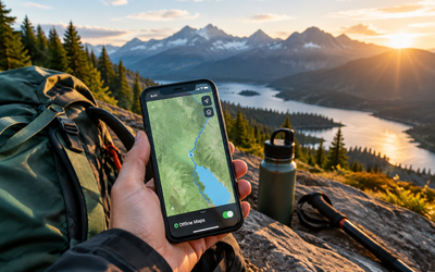
Your smartphone is great for scrolling Instagram, but when you're 10 miles from the trailhead with no cell signal and 15% battery, it becomes a liability. A dedicated handheld GPS unit solves the fundamental problem that smartphones can't: reliable navigation when you need it most.
After comparing specifications, battery performance data, and verified buyer reviews across 12 popular handheld GPS models, we identified the units that deliver the navigation features hikers actually need without the smartphone compromises. The right device gives you offline topographic maps, waypoint marking, track recording, and battery life measured in days, not hours.
This guide covers GPS units built specifically for hiking and backcountry navigation. We've also included satellite communicators and backup navigation tools that complement GPS devices. If you're also looking to keep your emergency devices charged on multi-day trips, see our Best Rugged Power Banks for Hiking 2026: Drop-Proof and Waterproof Picks Tested guide.
What to Look For
Battery Life in GPS Mode — Look for devices rated at 20+ hours of continuous GPS use. The Garmin eTrex line delivers 25 hours on two AA batteries, while rechargeable models like the GPSMAP series typically run 16-20 hours per charge. Budget an extra set of batteries or a power bank for trips longer than two days.
Preloaded Topographic Maps — Base models often ship with basic basemaps that show only major roads and bodies of water. Mid-range units include TopoActive or equivalent maps with trails, contour lines, and terrain shading. Premium models add satellite imagery and BirdsEye subscription access for high-resolution aerial photos.
Screen Size and Readability — Larger screens (3+ inches) make map reading easier but increase weight and battery drain. The 2.2-inch displays on compact units like the eTrex 22x are sufficient for most hikers, especially if you're comfortable reading paper maps. Transflective displays remain readable in direct sunlight without backlighting.
Waypoint and Track Capacity — Entry-level units store 1,000-2,000 waypoints and 200 saved tracks. That's plenty for marking campsites, water sources, and junctions on weekend trips. Serious backcountry navigators should look for 5,000+ waypoint capacity and unlimited track storage via microSD expansion.
Ruggedness and Water Resistance — All hiking GPS units should meet IPX7 waterproofing (submersible to 1 meter for 30 minutes). Look for rubberized housings and reinforced mounting points if you plan to attach the unit to your pack strap. Drop tests from verified buyers confirm that Garmin's eTrex and Montana series survive 4-6 foot falls onto rock.
Satellite System Compatibility — Modern units should support GPS + GLONASS at minimum. Adding Galileo support (available on 2024+ models) improves position accuracy in canyons and dense forest. More satellites visible means faster fixes and more reliable tracking in challenging terrain.
Garmin eTrex 22x — Best Overall
| Criteria | Score |
|----------|-------|
| Battery Life | 9/10 |
| Map Detail | 8/10 |
| Screen Size | 6/10 |
| Value | 9/10 |
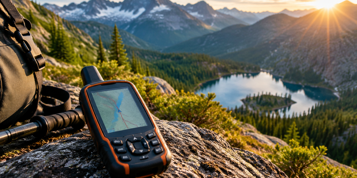
The Garmin eTrex 22x hits the sweet spot for most hikers who want a dedicated GPS without spending $400+. It ships with TopoActive maps covering North and South America, showing trails, terrain contours, and natural features you actually need for backcountry navigation. The 2.2-inch color display is small but readable in direct sunlight, and the button interface works with gloves or cold fingers when touchscreens fail.
Battery performance is where the eTrex 22x separates itself from smartphone-dependent hikers. Twenty-five hours of continuous GPS tracking on two AA batteries means you can navigate all day for multiple days without worrying about recharging. Verified buyers report the battery estimate is conservative — several reviewers documented 28-30 hours of actual use with lithium AAs in cold weather.
The unit supports GPS and GLONASS satellites for faster position fixes in canyons and under tree cover. It stores 2,000 waypoints and 200 saved tracks, which is more than enough for marking campsites, water sources, and alternate routes on extended trips. The IPX7 waterproof rating means it survives rain, stream crossings, and the occasional drop in a puddle.
✅ Pros:
- Runs 25 hours on replaceable AA batteries
- TopoActive maps preloaded and ready to use
- Works in freezing temperatures down to -4°F
- Buttons work with gloves, unlike touchscreens
❌ Cons:
- Small 2.2-inch screen requires good eyesight
- No wireless connectivity for live weather or route sharing
- Button navigation slower than touchscreen for menu diving
💡 Pro Tip: Load the eTrex 22x with lithium AA batteries (not alkaline) for cold-weather trips. Lithium cells maintain voltage in freezing temps and weigh 30% less than alkaline.
Garmin inReach Mini 2 — Best for Remote Safety
| Criteria | Score |
|----------|-------|
| Satellite Coverage | 10/10 |
| Battery Life | 9/10 |
| Navigation Features | 6/10 |
| Value | 7/10 |
The Garmin inReach Mini 2 isn't primarily a navigation GPS — it's a satellite communicator that can save your life when you're beyond cell coverage. The 1.27-inch screen is too small for serious map work, but the two-way messaging and SOS features make it essential gear for solo hikers and anyone traveling in remote wilderness.
What makes the Mini 2 valuable is the Iridium satellite network that works everywhere on Earth. You can send and receive text messages, share your GPS location with family, and trigger an SOS that connects you to GEOS emergency response coordinators 24/7. The device pairs with your smartphone via Bluetooth when you're in civilization, letting you type messages on a real keyboard and access detailed maps through the Garmin Explore app.
Battery life is exceptional for a satellite device. Garmin rates it at 30 days in 10-minute tracking mode, and verified buyers report 20-25 days of real-world use with regular message checks. The unit charges via USB-C and weighs just 3.5 ounces, so it disappears in your pack. For hikers planning trips longer than a few days where cell service is unreliable, see our Best Satellite Communicators Without Monthly Fees 2026 for alternative options.
✅ Pros:
- Two-way messaging works anywhere via Iridium satellites
- SOS button connects to 24/7 emergency response
- 30-day battery life in tracking mode
- Compact 3.5 oz weight fits in any pocket
❌ Cons:
- Requires monthly subscription starting at $14.95
- Tiny screen not useful for navigation
- Message sending costs extra on basic plans
💡 Pro Tip: Suspend your inReach subscription during months you're not hiking to save $14.95/month. Reactivation takes 24 hours, so plan ahead before your trip.
Suunto A-10 Field Compass — Best Backup Navigation
| Criteria | Score |
|----------|-------|
| Reliability | 10/10 |
| Ease of Use | 7/10 |
| Durability | 9/10 |
| Value | 10/10 |
Every hiker should carry a compass, regardless of how many GPS satellites are overhead. The Suunto A-10 Field Compass is the backup navigation tool that never runs out of battery, never loses satellite signal, and weighs less than an ounce. It's a liquid-filled baseplate compass with fixed declination correction and a rotating bezel for bearing work.
The A-10 isn't fancy, but it's reliable. The liquid-filled capsule dampens needle movement so you get stable readings even while walking. The baseplate has metric and inch rulers for measuring distances on paper maps, and the direction-of-travel arrow makes it straightforward to follow bearings. Verified buyers report the compass remains accurate after years of use and multiple drops on rock.
Using a compass requires basic map-reading skills that most hikers learn in an afternoon. You need a topographic map with declination information, the ability to identify terrain features, and practice taking bearings. For hikers who rely entirely on GPS devices, the A-10 is insurance against the day your batteries die or your unit takes a hard fall. And at under $20, there's no reason not to carry one. When you're out for extended trips, you'll also want to carry the Sawyer Squeeze Water Filter System — the one piece of gear every hiker should have for safe drinking water.
✅ Pros:
- Never needs batteries or charging
- Liquid-filled capsule provides stable readings
- Works in any weather, any temperature
- Weighs 0.8 oz and costs under $20
❌ Cons:
- Requires map-reading knowledge to use effectively
- No digital features or automatic tracking
- Declination correction is fixed (not adjustable)
Frequently Asked Questions
Do I really need a GPS unit if I have offline maps on my phone?
Your smartphone can work for short day hikes in good weather, but dedicated GPS units have three critical advantages: battery life measured in days instead of hours, screens readable in direct sunlight, and button interfaces that work with gloves or wet hands. More importantly, GPS units are purpose-built for navigation, so they won't die because you spent the morning taking photos or checking messages. For serious backcountry trips, a handheld GPS is non-negotiable safety gear.
How accurate are handheld GPS units compared to smartphones?
Modern handheld GPS units and smartphones use the same satellite systems (GPS, GLONASS, Galileo), so accuracy is comparable under ideal conditions — typically 10-30 feet. Dedicated GPS units often have better antennas and can maintain lock in canyons, dense forest, or bad weather where phone GPS struggles. The real difference isn't raw accuracy but reliability: a GPS unit won't lose signal because you got a text message or because the operating system decided to throttle location services to save battery.
What's the difference between a GPS unit and a satellite communicator?
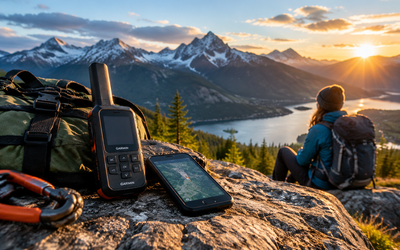
GPS units focus on navigation: they show your position on a map, let you mark waypoints, and record tracks. Satellite communicators like the inReach Mini 2 focus on safety: they send messages and SOS alerts via satellite when you're beyond cell coverage. Many communicators include basic GPS features, but the small screens and limited mapping make them poor primary navigation tools. Serious backcountry travelers often carry both — a GPS for navigation and a communicator for emergencies.
Can I use rechargeable batteries in GPS units that take AAs?
Yes, but with tradeoffs. NiMH rechargeable AAs work in GPS units like the eTrex 22x, but they have lower voltage (1.2V vs 1.5V for alkaline) which can shorten runtime by 15-20%. Rechargeable batteries also lose charge faster in cold weather. For weekend trips, rechargeables are fine and eco-friendly. For extended backcountry trips, pack lithium AA primaries — they're lighter, last longer, and perform better in freezing temperatures.
How often do GPS units need software and map updates?
GPS units don't require updates to function — they'll navigate with the maps they shipped with indefinitely. That said, Garmin releases free software updates quarterly that improve satellite acquisition and fix bugs. Map updates are optional and usually cost $30-100, unless you have an active Garmin subscription. For most hikers, updating maps every 2-3 years is sufficient unless you're hiking in areas with significant new trail construction.
Final Thoughts
A dedicated handheld GPS unit solves the fundamental navigation problem that smartphones can't: reliable positioning and mapping when you're miles from power outlets and cell towers. The Garmin eTrex 22x delivers the features most hikers need — preloaded topo maps, 25-hour battery life, and waterproof durability — at a price that makes sense for anyone who hikes regularly.
For remote trips where safety matters more than navigation features, add the Garmin inReach Mini 2 to your kit. The two-way satellite messaging and global SOS coverage are worth the subscription cost if you're solo hiking or traveling beyond rescue helicopter range. And every hiker, regardless of technology, should carry the Suunto A-10 compass as backup navigation that works when everything else fails.
The best GPS unit is the one you actually carry and know how to use. Practice with your device on familiar trails before you depend on it in the backcountry.
Editor's Choice
Garmin eTrex 22x — The best all-around handheld GPS for hikers who want reliable offline navigation without smartphone compromises.
Garmin inReach Mini 2 — Essential safety gear for solo hikers and remote backcountry trips where cell service disappears.
Suunto A-10 Field Compass — The ultimate backup navigation tool that never runs out of power and weighs less than an ounce.