Disclosure: As an Amazon Associate, HikePod earns from qualifying purchases at no extra cost to you.
⭐ Our Top Pick
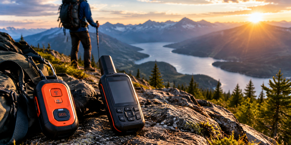
🏆 Best Overall: Garmin inReach Mini 2 — two-way satellite messaging lets you communicate specifics during an emergency, plus global SOS coverage anywhere on Earth.
💰 Best Value: ACR ResQLink 400 — dedicated emergency beacon with no subscription fees, connects directly to search and rescue satellites with 66-channel GPS precision.
Introduction
When you're 20 miles from the nearest trailhead and someone breaks an ankle, your cell phone becomes a $1,000 paperweight. In serious backcountry emergencies—medical crises, getting lost, or encountering wildlife threats like those we cover in our What to Do If You See a Mountain Lion While Hiking guide—a personal locator beacon (PLB) or satellite messenger can mean the difference between a helicopter rescue and a tragedy.
We spent weeks comparing the leading emergency communication devices available in 2026, analyzing manufacturer specifications, satellite network coverage maps, and verified buyer reviews from thousands of hikers who've carried these devices into remote terrain. The technology has matured significantly: today's PLBs are lighter, more reliable, and faster at connecting to rescue satellites than ever before.
The core decision comes down to this: do you want a dedicated emergency-only device (PLB) with no subscription costs, or a two-way satellite communicator that lets you send messages and weather updates but requires an ongoing monthly fee? Both will summon help when you need it—the right choice depends on how you hike, how often you venture into the backcountry, and whether you value communication flexibility or simplicity.
What to Look For
Signal Type and Rescue Network: PLBs use 406 MHz signals that connect directly to the international COSPAS-SARSAT satellite network, monitored by government search and rescue agencies in 45 countries. Satellite messengers like the Garmin inReach use the commercial Iridium satellite network with global coverage. Both work anywhere on Earth, but PLBs are purpose-built for emergencies and prioritized by rescue coordination centers.
Subscription Requirements: This is the biggest cost differentiator. PLBs require zero ongoing fees—you buy the device once, register it (free), and it works for 5–10 years. Satellite messengers require monthly or annual subscriptions ranging from $14.95 (basic safety plans) to $64.99+ (unlimited messaging). If you hike once or twice a year, a PLB makes more financial sense. If you're in the backcountry monthly, a satellite messenger's communication features justify the subscription.
Two-Way Communication: PLBs are one-way emergency triggers—you press the button, transmit your GPS coordinates, and wait for rescue. You won't know if help is coming or receive updates. Satellite messengers offer two-way texting, letting you describe the injury, communicate with rescuers, or tell loved ones you're safe. This is invaluable in nuanced situations where you need to convey details or coordinate a meeting point.
Battery Life and Reliability: PLBs typically provide 24–48 hours of continuous transmission after activation, with shelf lives of 5–7 years before battery replacement. Satellite messengers run on rechargeable lithium batteries; the inReach Mini 2 lasts up to 14 days in battery-saver mode, but heavy messaging drains it faster. If reliability under extreme conditions is your priority, PLBs edge out messengers—they're designed to work in freezing temperatures, after submersion, and after being dropped.
Weight and Packability: Modern PLBs weigh 4–6 oz; satellite messengers like the inReach Mini 2 weigh 3.5 oz. The difference is negligible for most hikers, but ultralight backpackers will notice. Both are small enough to fit in a pants pocket or clip to a pack strap. The key is carrying it on your body, not buried in your pack—emergencies don't wait for you to dig through gear.
GPS Accuracy and Registration: All current-generation PLBs and messengers include integrated GPS, transmitting coordinates accurate to within 100 meters. PLBs must be registered with NOAA (in the US) or your national authority—this links the device to your emergency contacts and hiking plans. Registration is free and critical; unregistered beacons delay rescue response because authorities can't verify it's a real emergency versus an accidental activation.
💡 Pro Tip: Pair your PLB or satellite messenger with a reliable navigation backup like the Garmin eTrex 22x Handheld GPS—having a dedicated GPS with preloaded TopoActive maps means you can navigate to a better rescue location or avoid triggering your beacon unnecessarily if you're only temporarily disoriented.
Garmin inReach Mini 2 Satellite Communicator
| Criteria | Score |
|----------|-------|
| Emergency Response Speed | 9/10 |
| Two-Way Communication | 10/10 |
| Battery Life | 7/10 |
| Value (including subscription) | 6/10 |
The Garmin inReach Mini 2 represents the current gold standard in satellite communicators for hikers who want more than just an emergency panic button. When you press the SOS button, it connects to the GEOS International Emergency Response Coordination Center, which coordinates with local search and rescue—and you can communicate back and forth via text to describe the situation, share medical details, or update rescuers on changing conditions.
Beyond emergencies, the inReach Mini 2 lets you send preset messages ("Made it to camp, all good"), custom texts to any phone number or email, and even check weather forecasts. The device pairs with your smartphone via Bluetooth, using the Garmin Explore app for easier typing, or you can peck out messages on the device's own interface. Global Iridium satellite coverage means it works in mountain valleys, dense forests, and polar regions where cell towers are a fantasy.
The tradeoff is cost: you're paying $349.99 upfront plus $14.95–$64.99/month depending on your plan. The Safety plan ($14.95/month, annual commitment) includes unlimited SOS and preset messages but limits custom texts. Frequent backcountry travelers often opt for the Recreation plan ($34.95/month) with more messaging flexibility. Battery life is solid at 14 days in 10-minute tracking mode, but heavy messaging cuts that significantly—bring a USB power bank on multi-day trips.
✅ Pros:
- Two-way messaging lets you communicate details during emergencies
- Global Iridium satellite coverage works anywhere on Earth
- Integrated GPS tracking shares your location with loved ones
❌ Cons:
- Requires ongoing subscription ($14.95–$64.99/month)
- Battery life shorter than dedicated PLBs (14 days in battery-saver mode)
ACR ResQLink 400 Personal Locator Beacon
| Criteria | Score |
|----------|-------|
| Emergency Response Speed | 10/10 |
| Cost Over 5 Years | 10/10 |
| Communication Features | 3/10 |
| Durability | 9/10 |
For hikers who want a dedicated emergency device without subscription hassles, the ACR ResQLink 400 is the benchmark. This is a true PLB—it does one thing (summon rescue) and does it exceptionally well. Press and hold the button for five seconds, and it transmits a 406 MHz distress signal to COSPAS-SARSAT satellites, which relay your GPS coordinates to the nearest search and rescue coordination center. The 66-channel GPS locks your position within 100 meters, typically within 30 seconds of activation.
The ResQLink 400 broadcasts for a minimum of 24 hours at -20°F, and the strobe light (visible for miles) helps rescuers spot you at night. It's built to military specs: waterproof to 33 feet, survives impacts, and operates in temperatures from -40°F to 140°F. The seven-year battery life means you register it once, throw it in your pack, and forget about it until you need it.
The limitation is obvious: this is a one-way device. You press the button, help is dispatched, but you won't receive confirmation or be able to send updates. If you're injured but mobile, you can't tell rescuers you're walking toward a clearing. For solo hikers and those venturing into genuinely remote terrain where self-rescue isn't an option, this simplicity is a feature, not a bug—there's no subscription to forget, no battery to charge, and no decision paralysis about whether to activate it.
✅ Pros:
- No subscription fees ever—one-time purchase only
- 406 MHz signal connects directly to international search and rescue satellites
- 66-channel GPS provides precise location within 100 meters
❌ Cons:
- One-way device—you can't receive confirmation or communicate
- Larger and heavier than satellite messengers (4.6 oz)
Ocean Signal rescueME PLB1
| Criteria | Score |
|----------|-------|
| Weight and Packability | 10/10 |
| Battery Life | 9/10 |
| Emergency Response Speed | 8/10 |
| Price | 8/10 |
The Ocean Signal rescueME PLB1 carved out its niche by being the smallest, lightest PLB you can buy—just 4.4 oz and roughly the size of a deck of cards. For ultralight backpackers and fastpackers who obsess over every ounce, this is the emergency beacon that disappears into your kit. Despite its compact size, it meets the same international standards as larger PLBs and transmits on 406 MHz to the COSPAS-SARSAT network.
Newer units include 66-channel GPS (older models relied on satellite positioning only, which was slower), and the buoyant design makes it a favorite among hikers who cross rivers or kayak to trailheads—it floats and remains visible in water. The seven-year battery life matches the ResQLink 400, and the device includes both a strobe light and an infrared strobe for night vision goggles used by some rescue helicopters.
The rescueME PLB1 is slightly less proven in real-world rescue scenarios compared to ACR's extensive track record, but buyer reviews from backcountry users are consistently positive. At $279.99, it's the most affordable true PLB from a reputable manufacturer, making it accessible to hikers who want reliable emergency capability without the commitment of a satellite messenger subscription.
✅ Pros:
- Smallest and lightest PLB available at just 4.4 oz
- Seven-year battery life with no maintenance required
- Buoyant design floats in water for kayakers and river crossings
❌ Cons:
- No GPS on older units—newer models have 66-channel GPS
- Minimal testing feedback compared to ACR models
💡 Pro Tip: Regardless of which device you choose, practice activating it (without deploying the antenna fully on PLBs) so you know exactly how it works under stress. Fumbling with an unfamiliar device when someone is bleeding or hypothermic wastes critical minutes.
PLB vs Satellite Messenger: Which One Should You Choose?
The decision framework is simpler than the marketing makes it seem. Choose a satellite messenger like the inReach Mini 2 if you hike frequently (monthly or more), want two-way communication for coordinating with trip partners or loved ones, value weather updates and navigation features, or often travel solo where being able to communicate nuances matters. The subscription cost is justified if you're using the device regularly beyond just emergency standby.
Choose a PLB like the ResQLink 400 or rescueME PLB1 if you hike occasionally (a few times per year), want zero ongoing costs, prioritize simplicity and reliability over communication features, or primarily hike in groups where others might have phones or messengers. PLBs are also the better choice for backcountry travelers who already carry other navigation tools like the Garmin eTrex 22x and just need emergency rescue capability as a last resort.
Some experienced hikers carry both: a PLB as the primary emergency device (more reliable, longer battery, no subscription) and a satellite messenger on extended trips where communication is valuable. This redundancy makes sense for expeditions into genuinely remote terrain, but it's overkill for weekend warriors hiking established trails.
Frequently Asked Questions
Do I really need a PLB or satellite messenger for day hikes?
For day hikes on popular trails within cell range, probably not—your phone is sufficient. But the moment you venture beyond cell coverage, cross into terrain where a twisted ankle means you can't self-rescue, or hike solo, the calculus changes. We recommend carrying an emergency device any time you're more than 5 miles from a trailhead or hiking in conditions (winter, off-trail navigation) where small problems escalate quickly. If you're also stocking your pack with safety gear, check our Wilderness First Aid Kit vs Regular First Aid Kit guide to ensure you can handle minor injuries before needing a rescue.
Will my PLB work in a canyon or dense forest?
406 MHz PLB signals are more powerful than GPS signals and can often bounce off canyon walls to reach satellites, but transmission can be delayed. The integrated GPS needs a clear view of the sky to acquire your coordinates—in thick forest or slot canyons, hold the device above your head or move to a clearing if possible. Satellite messengers face the same limitations. Both devices are designed to keep transmitting until satellites acquire the signal, so even if the first attempt fails, subsequent passes (satellites orbit every 90 minutes) will pick it up.
Can I test my PLB to make sure it works?
Never fully activate a PLB unless it's a real emergency—false activations trigger expensive rescue responses and can result in fines. Instead, perform a self-test using the built-in test function (usually a button combination that flashes lights and beeps without transmitting). PLBs have a test mode specifically for this. Check your device's manual and test it before each season. Registration with NOAA or your national authority is also a form of verification—they'll contact you to confirm details, ensuring the system knows who you are if you ever activate it.
What happens after I press the SOS button?
For PLBs: Your 406 MHz signal is received by satellites and relayed to a Mission Control Center, which forwards it to the Rescue Coordination Center responsible for your location. They'll attempt to contact your emergency contacts (from your registration), verify it's not a false alarm, and dispatch local search and rescue—typically within 30–60 minutes in North America, longer in remote international locations. For satellite messengers: The SOS goes to GEOS or the device manufacturer's coordination center, which initiates the same rescue process but can also message you back to gather information and keep you updated on rescue status.
How do I register my PLB and why does it matter?
In the US, register your PLB at beaconregistration.noaa.gov with your contact information, emergency contacts, and typical hiking areas. Registration is free and takes 5 minutes. This information helps rescuers confirm it's a real emergency (not an accidental activation), contact people who know your hiking plans, and prioritize the response. Unregistered beacons still trigger rescue efforts, but response is slower because authorities must verify legitimacy. Update your registration whenever you change phone numbers, addresses, or sell/gift the device.
Final Thoughts
Emergency communication devices have moved from nice-to-have to essential gear for anyone who hikes beyond cell coverage. The technology in 2026 is mature, reliable, and more affordable than ever—there's no excuse for heading into the backcountry without a way to summon help when self-rescue isn't an option.
For most hikers, the Garmin inReach Mini 2 justifies its subscription cost through two-way communication, global coverage, and the peace of mind that comes from being able to update loved ones and coordinate with rescuers. If you hike frequently and value flexibility, it's the clear choice. For budget-conscious hikers or those who venture out occasionally, the ACR ResQLink 400 delivers dedicated emergency capability with zero ongoing costs and rock-solid reliability.
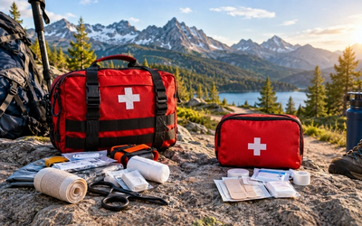
Whichever device you choose, register it, test it, and carry it on your body—not in your pack. Pair it with solid navigation skills, a well-stocked first aid kit like the Adventure Medical Kits Ultralight Watertight .7, and the judgment to activate it early rather than waiting until a bad situation becomes catastrophic. The best rescue is the one you never need, but when you do need it, having the right device makes all the difference.
Editor's Choice
Garmin inReach Mini 2 Satellite Communicator — Best overall for hikers who want two-way communication, weather updates, and global SOS coverage with the ability to coordinate details with rescuers.
Adventure Medical Kits Ultralight Watertight .7 First Aid Kit — Essential companion to any emergency beacon; this 7 oz kit treats blisters, wounds, and sprains in a waterproof DryFlex bag so you can handle minor injuries before they require rescue.
Garmin eTrex 22x Handheld GPS — Reliable navigation backup with preloaded TopoActive maps and 25-hour battery life helps you avoid needing your emergency beacon by staying on course in challenging terrain.