Disclosure: As an Amazon Associate, HikePod earns from qualifying purchases at no extra cost to you.
⭐ Our Top Pick
🏆 Best Overall: Garmin inReach Mini 2 — two-way satellite messaging and SOS anywhere on Earth means rescue crews know your exact location when water cuts you off from cell service.
💰 Best Value: Suunto A-10 Field Compass — a $20 liquid-filled compass that never needs batteries and always points to high ground when GPS fails in a storm.
Introduction
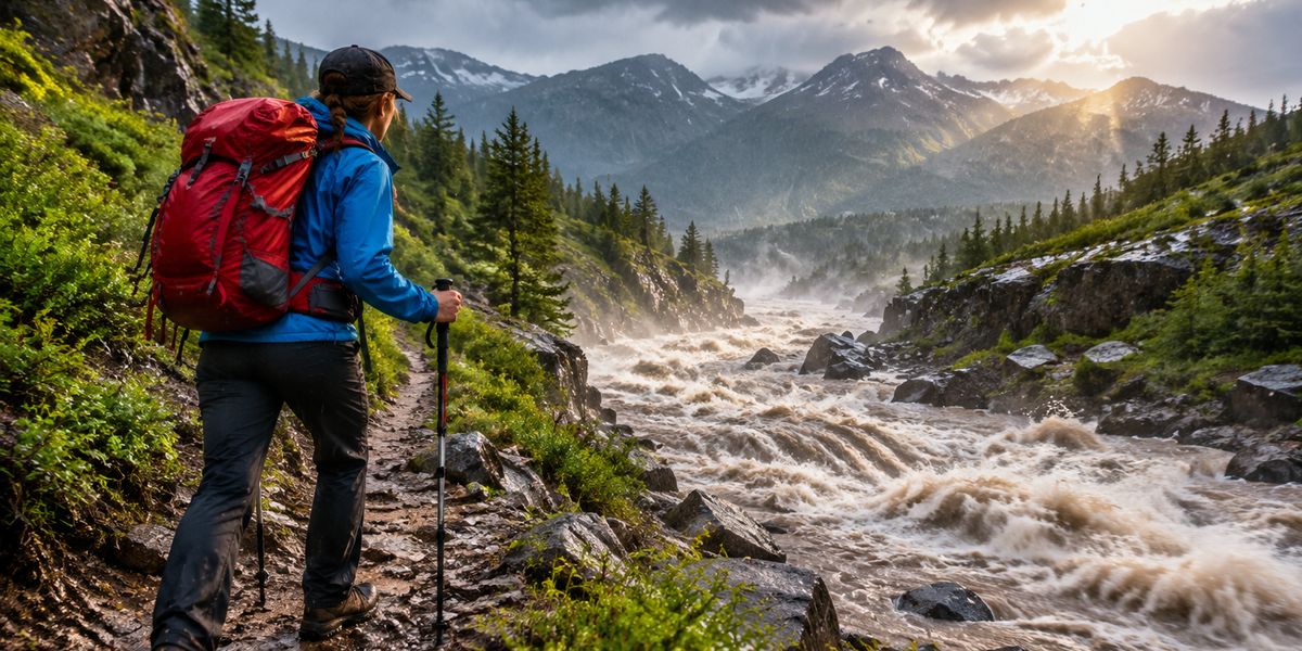
Flash floods kill more people in the United States than tornadoes, hurricanes, or lightning. In 2025 alone, 78 hikers died in flash flood events, most of them in narrow canyons and dry washes that seemed perfectly safe an hour earlier. Unlike river flooding that builds over days, flash floods rise in minutes, turning a peaceful trail into a debris-filled torrent with almost no warning.
We compiled data from the National Weather Service, search-and-rescue case files, and survivor accounts to identify the warning signs most hikers miss and the escape tactics that actually work when water starts rising. This guide focuses on terrain reading, weather pattern recognition, and split-second decision-making — the skills that separate close calls from fatalities.
You'll learn to spot the cloud formations that precede canyon floods, recognize terrain traps before you enter them, and execute the escape routes that give you the best chance of reaching high ground before the water does. If you're also preparing for other weather emergencies, see our Lightning Safety While Hiking: When to Turn Back and How to Shelter in 2026 guide.
What to Look For
Upstream Weather Monitoring — Flash floods often originate miles away from where you're hiking. A clear sky overhead means nothing if thunderstorms are dumping rain in the watershed above you. Before entering slot canyons or following creek beds, check radar for the entire drainage basin. The Garmin inReach Mini 2 lets you receive weather updates via satellite when you're beyond cell range, giving you advance warning of storms forming upstream.
Terrain Features That Amplify Danger — Certain landscapes concentrate floodwater into lethal funnels. Slot canyons with vertical walls, stream crossings in narrow gorges, campsites on gravel bars below the high-water line, and trails that follow the bottom of V-shaped valleys all become death traps during flash floods. Study topo maps before your hike and identify escape routes to high ground every quarter-mile.
Water Level Changes and Debris Patterns — Water rising even two inches in five minutes means a wall of water is coming. Watch for fresh mud on canyon walls above your head, newly deposited logs and branches wedged in rock crevices, and water that changes from clear to brown or gains a muddy smell. These signs mean water is already moving through the system upstream.
Cloud Formations and Atmospheric Cues — Towering cumulonimbus clouds with dark, flat bases dump the intense rainfall that triggers flash floods. If you see anvil-shaped cloud tops or hear thunder, assume heavy rain is falling somewhere in your watershed. Rain doesn't need to reach you to create a flood — a storm 10 miles upstream can send a wave through a dry canyon in under 30 minutes.
Communication and Navigation Backup — Cell service disappears in remote canyons exactly when you need it most. Satellite communicators and GPS units with preloaded topo maps turn potential tragedies into successful self-rescues. The Garmin eTrex 22x shows terrain contours in real-time so you can navigate to high ground even when trails wash away and visibility drops to zero.
Physical Fitness and Gear Readiness — Escaping a flash flood often means scrambling uphill through loose scree or climbing hand-over-hand up steep terrain while soaking wet and carrying a full pack. If your fitness level or your group's abilities don't match the terrain's demands, choose routes with gentler escape options.
💡 Pro Tip: Carry a whistle and a headlamp on every hike, even day trips. Three short whistle blasts is the universal distress signal, and a headlamp lets you navigate to safety if a storm delays you past sunset.
Understanding Flash Flood Mechanics
Flash floods differ from regular flooding in both speed and violence. Normal river floods rise gradually over hours or days, giving people time to evacuate. Flash floods surge with almost no warning, often as a wall of water three to ten feet high traveling 10–20 mph through confined spaces.
The trigger is always intense rainfall over a small area in a short time — typically one to two inches per hour sustained for 30 minutes or more. This rainfall doesn't need to fall where you're standing. A thunderstorm 15 miles upstream can send water cascading down into narrow canyons and dry washes you're hiking through under clear skies.
Drainage basins funnel water from wide areas into narrow channels. A watershed of 50 square miles might concentrate all its runoff into a canyon 30 feet wide. The smaller the outlet, the faster and higher the water rises. This is why slot canyons and box canyons (dead-end gorges with no exit) claim the most lives — there's nowhere to go when water fills the space.
Debris makes flash floods more lethal than the water depth suggests. A flood two feet deep sounds survivable, but when it's carrying logs, rocks, and uprooted trees at 15 mph, it hits with enough force to break bones and knock you unconscious. Even six inches of fast-moving water can sweep an adult off their feet.
Reading Warning Signs in Real Time
The most reliable early warning is often sensory, not technological. Many survivors report a low roar or rumble — like distant thunder or a freight train — seconds to minutes before water arrives. This sound is the flood churning through the canyon upstream, grinding rocks and snapping trees.
Water color and clarity change before flow increases noticeably. Clear water turning muddy brown or gaining a strong earthy smell means soil erosion upstream — evidence of heavy rain already falling in the watershed. If you see this change, start moving to high ground immediately. Don't wait to see how high the water gets.
Animal behavior sometimes provides advance warning. Birds flying low or leaving an area suddenly, lizards and snakes moving uphill away from washes, and unusual silence from insects and frogs all suggest animals sense atmospheric pressure changes or ground vibrations before water arrives. These cues aren't foolproof, but when they align with weather conditions, take them seriously.
Cloud formations overhead tell you what's happening miles away. Dark, bulging cloud bases that seem to hang low indicate heavy precipitation. If you can see rain curtains (gray sheets of rain) falling from clouds in any direction within your drainage basin, assume flash flood conditions exist and leave the hazard zone.
Garmin inReach Mini 2 Satellite Communicator
| Criteria | Score |
|----------|-------|
| Communication Range | 10/10 |
| Battery Life | 9/10 |
| Emergency Response | 10/10 |
| Ease of Use | 8/10 |
The inReach Mini 2 creates a lifeline when flash floods cut you off from cell service and strand you in terrain where self-rescue isn't possible. Two-way satellite messaging works anywhere on Earth with a clear view of the sky, letting you text your exact GPS coordinates to emergency contacts or trigger a dedicated SOS that alerts GEOS International Emergency Response Coordination Center.
Battery life reaches 14 days in power-save mode or seven days with 10-minute tracking intervals — more than enough to outlast multi-day storms or extended search-and-rescue operations. The device weighs just 3.5 ounces and fits in a shirt pocket, so you'll actually carry it instead of leaving it in the car because it's too bulky.
The subscription requirement is the main drawback. Plans start at $14.95/month for basic messaging and go up to $64.95/month for unlimited texts and premium weather forecasts. But when a flash flood traps you on a ledge 200 feet above a raging torrent with no cell signal and darkness approaching, that monthly fee becomes the best money you ever spent.
✅ Pros:
- Works everywhere with clear sky view — no cell towers needed
- SOS button connects directly to 24/7 emergency response center
- Can send and receive custom messages, not just preset phrases
- Seven-day battery life in tracking mode outlasts most rescue operations
❌ Cons:
- Monthly subscription required even when not actively hiking
- Small screen difficult to read in direct sunlight without shade
Garmin eTrex 22x Handheld GPS
| Criteria | Score |
|----------|-------|
| Map Detail | 9/10 |
| Battery Life | 10/10 |
| Waterproofing | 9/10 |
| Screen Visibility | 7/10 |
The eTrex 22x comes preloaded with TopoActive maps covering all of North America, showing terrain contours, water features, and elevation profiles that help you identify escape routes when trails vanish under rising water. The 2.2-inch color screen is readable in rain and bright sun, though resolution is lower than modern smartphones.
Battery life is exceptional — 25 hours on two AA batteries means you can navigate through extended storms and overnight emergencies without worrying about power. The IPX7 waterproof rating handles full submersion up to one meter for 30 minutes, so brief immersion during a water crossing or getting knocked down by current won't kill the unit.
The main limitation is no communication capability. This device shows you where you are and where you need to go, but it can't call for help or send messages. Pair it with the inReach Mini 2 for the complete solution — GPS for navigation, satellite for communication.
✅ Pros:
- Preloaded topo maps show terrain and water features without cell service
- 25-hour battery life on two AA batteries outlasts most storms
- IPX7 waterproof rating survives rain, splashes, and brief submersion
- Physical buttons work with wet hands and gloves
❌ Cons:
- No communication or SOS features
- Screen resolution noticeably lower than smartphones
- Can't download new maps without computer connection
Escape Route Selection and Execution
When water starts rising, your survival depends on moving perpendicular to the flow, not parallel to it. Trying to outrun water downstream or upstream rarely works — floods move faster than humans can run, especially on uneven terrain while carrying a pack.
The correct escape is almost always straight uphill to high ground, even if that means bushwhacking through dense vegetation or scrambling up loose scree. Gain 20 to 30 vertical feet as fast as possible — that puts you above the typical flash flood crest in most terrain. If the terrain allows it, get 50 to 100 feet up to be certain.
Drop non-essential gear if it slows your climb. Your pack, tent, and sleeping bag can be replaced. Your life cannot. Keep only what helps you survive after the flood: water, shelter layer, first aid kit like the Adventure Medical Kits Ultralight Watertight, headlamp, and communication device.
If water cuts you off from both upstream and downstream escape and canyon walls are vertical, climb onto the largest boulder or ledge you can reach. Get above the waterline and wait it out. Flash floods typically crest and recede within 30 minutes to two hours. The danger is being swept away or battered by debris, not prolonged immersion.
Never try to cross moving water deeper than your knees or flowing faster than you can walk. Six inches of water moving at 10 mph generates enough force to knock an adult down. Twelve inches can float a car. If you must cross, unbuckle your pack hip belt and sternum strap so you can shed the pack instantly if you fall.
💡 Pro Tip: Practice reading topo maps before emergencies strike. Spend 30 minutes each planning session identifying the high ground, ridge lines, and escape routes along your intended route. When water starts rising, you won't have time to figure it out.
Terrain Traps to Avoid
Slot canyons are the deadliest terrain for flash floods. These narrow gorges with vertical walls sometimes only three to five feet wide funnel water into a confined space with nowhere to escape. Even a flood only four feet deep becomes unsurvivable when it fills the entire width of the passage and carries you into underwater obstacles.
Box canyons and dead-end gorges trap hikers between rising water and impassable cliffs. Always scout your route on maps before entering. If there's only one way in and one way out, a flash flood can cut off your exit before you realize what's happening.
Campsites on gravel bars, sandbars, or islands in the middle of stream channels flood first and fastest. These features exist because previous floods deposited sediment there — evidence that water regularly covers these spots. Camp at least 50 vertical feet above current water level and never pitch your tent in a dry wash, no matter how appealing the flat, soft sand appears.
Stream crossings in narrow gorges become impassable torrents during flash floods. If your planned route requires crossing moving water in a confined canyon, scout alternate routes that keep you on high ground. A dry ford at 9 AM can become a 10-foot-deep rapids by 2 PM.
Gullies and dry washes that seem insignificant in dry weather become deadly channels during storms. That sandy depression cutting across the trail might only be three feet deep, but when it's carrying a six-foot wall of water, it's enough to kill you. Step across dry washes quickly and never linger in them.
Post-Flood Hazards and Survival
Flash floods create secondary dangers that persist after the water recedes. Hypothermia is the most immediate threat — even if air temperature is 70°F, soaking wet clothes and wind chill can drop your core temperature to dangerous levels within 30 minutes. Strip off wet clothes, wring them out, and put them back on. Wet clothes provide more insulation than bare skin. If you're carrying dry layers, change into them immediately. For more detailed guidance on managing cold-related injuries, see our How to Recognize and Treat Hypothermia on the Trail: A Complete 2026 Guide.
Contaminated water causes illness days after the event. Floodwater carries sewage, agricultural runoff, chemicals, and decomposing organic matter. Treat all water sources in flood-affected areas as contaminated. Boil water for at least one minute or use a filter rated for bacteria and protozoa.
Unstable terrain makes post-flood navigation hazardous. Trails wash away, bridges collapse, and slopes that were stable before the flood become prone to landslides. Move slowly, test each foothold, and don't assume the route that got you in will still exist on the way out.
Injuries from debris impact often don't manifest immediately. Adrenaline masks pain during the escape, and you might not realize you've broken ribs, sprained joints, or sustained deep bruising until hours later. Check yourself and your group for injuries once you reach safety. The Adventure Medical Kits Ultralight Watertight includes wound care supplies and elastic wraps for sprains in a DryFlex bag that stays waterproof even after full submersion.
Frequently Asked Questions
How much rain triggers a flash flood?
Flash floods typically form when one to two inches of rain falls in less than an hour over a localized area. The exact threshold depends on soil saturation, ground cover, and terrain slope. In desert environments with hard-packed soil and minimal vegetation, even half an inch in 30 minutes can generate dangerous runoff. The key isn't the total rainfall but the intensity — heavy rain over a short period overwhelms the ground's ability to absorb water.
Can flash floods happen when it's not raining where I'm standing?
Absolutely, and this is what makes them so deadly for hikers. Flash floods originate wherever intense rain falls in the watershed, which can be miles from where you're hiking. A storm 10 miles upstream in a canyon can send a wall of water through your location under clear blue skies with no warning except the distant rumble of approaching water. Always check weather for the entire drainage basin, not just your immediate area.
What's the best way to cross moving water during a flash flood?
Don't. If water is rising and moving fast enough to be considered a flash flood, attempting to cross it is almost always fatal. Six inches of moving water can knock you down. Twelve inches can carry you away. Instead, move perpendicular to the flow and gain elevation. If you're already trapped by rising water, climb onto the highest boulder or ledge you can reach and wait for the water to recede, which typically happens within 30 minutes to two hours.
Should I try to save my gear or prioritize getting to high ground?
Get to high ground first, always. Drop your pack if it slows your climb or creates entanglement hazards in moving water. Keep only critical survival items: water, shelter layer, first aid kit, headlamp, and communication device. Everything else can be replaced. The few extra seconds spent wrestling with a pack strap or trying to save a tent have cost people their lives.
How do I know if terrain is high enough to be safe from flash floods?
Look for high-water marks on canyon walls — staining, debris lodged in rock crevices, and vegetation stripped from lower sections. These marks show how high previous floods reached. Aim to climb at least 20 to 30 vertical feet above the current water level as a minimum safety margin. In narrow canyons with a history of extreme floods, get 50 to 100 feet up if possible. When in doubt, climb higher than you think necessary — floods regularly exceed predicted levels.
Final Thoughts
Flash flood survival comes down to reading terrain correctly, monitoring weather continuously, and acting decisively when warning signs appear. The hikers who survive these events are the ones who leave hazard zones early, before water rises, not the ones who try to outrun the flood once it starts.
Invest in the right gear — a satellite communicator for emergencies, a GPS with topo maps for navigation, and a waterproof first aid kit for post-flood injuries. But more importantly, invest time in learning to read weather patterns and terrain features. The best survival tool is the knowledge to avoid flash flood terrain on days when atmospheric conditions are right for intense storms.
Check the forecast before every hike, not just for your trailhead but for the entire watershed. If thunderstorms are predicted anywhere upstream, choose a different route on higher ground. Your life is worth more than any summit or canyon you planned to see. The wilderness will still be there when conditions are safer.
Editor's Choice
Garmin inReach Mini 2 — Two-way satellite messaging and SOS anywhere on Earth means rescue crews can reach you when flash floods cut you off from cell service and strand you on high ground waiting for water to recede.
Adventure Medical Kits Ultralight Watertight .7 First Aid Kit — The DryFlex bag keeps wound care supplies and medications dry even when your pack gets soaked, and at only 7 oz it won't slow your scramble to safety.
Garmin eTrex 22x Handheld GPS — Preloaded TopoActive maps show terrain contours and water features so you can navigate to high ground even when trails wash away and visibility drops to zero in heavy rain.